1
2
3
4The Vitry-le-François Arboretum
The arboretum showcases the plant heritage as well as 41 remarkable trees, all located on an accessible map in the centre of the garden. A QR code provides access to a description of each tree.
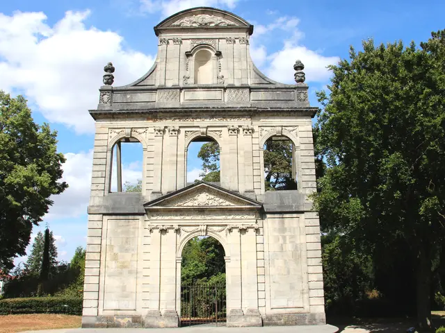
5Façade du Collège des Garçons
Built in 1568 and extended with a chapel in the 18th century. The façade remained intact after the war and was dismantled and rebuilt in the garden of the Town Hall. Today it is an open-air theatre that hosts outdoor performances.
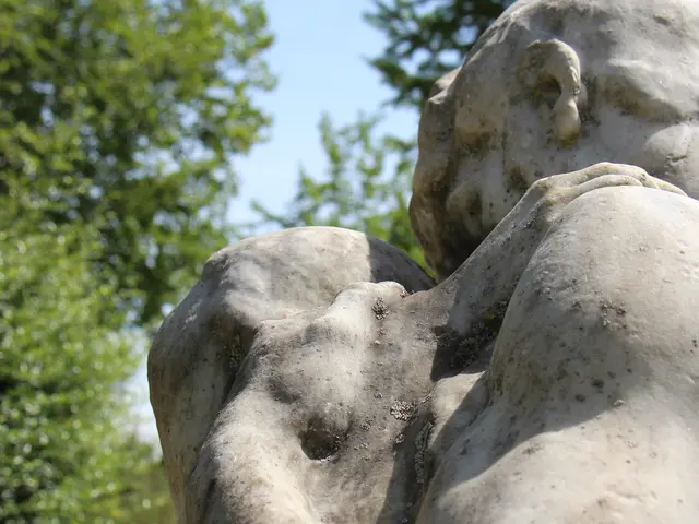
6Adam and Eve
A work in Carrara marble donated by the City of Paris and created by Alphonse Terroir during his stay at the Villa Medici in Rome from 1903 to 1907. It depicts Eve's anguish at the mystery of childbirth, which Adam is unable to explain to her.
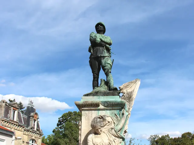
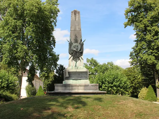
7Sadi Carnot Monument
Standing 7 metres tall, this bronze work by sculptor Ernest Dagonet was erected in memory of the former president who was assassinated in 1894. On the main shaft of the column, a bas-relief depicts troops marching past the presidential tribune, a reminder of the great manoeuvres.
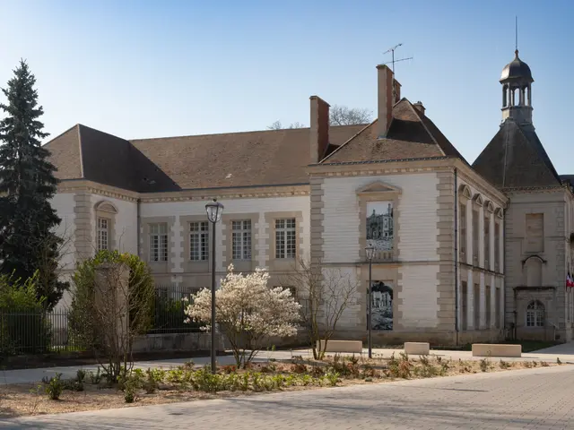
8Town Hall
Former convent built in 1624 by the Récollets religious order, who were responsible for combating Protestantism at the time. The town hall moved there during the Revolution after renovation work that gradually removed the church. Largely demolished during the last war, the building was rebuilt, largely based on its previous appearance.
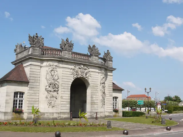
9Porte du Pont
Remains of the fortified Vitry, formerly located on the Paris-Strasbourg road near a bridge spanning an old branch of the Marne River. Decorated with numerous military emblems and weapons, the gate was dismantled in 1939 in the face of invasion threats, and only rebuilt in 1985 at its current location, considered more secure.
10Minimes Garden
The gate serves as the entrance to the gardens located on the site of the Minimes convent, built around 1610 as part of the Counter-Reformation. Crossing this garden, you can access the oldest district of Vitry-le-François, where you can see the old prison from the street and numerous half-timbered houses.
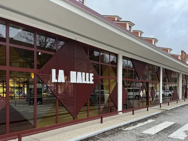
11La Halle
The original market hall had a chestnut wood frame and a floor covered with small cobblestones. It was listed as a historic monument before being destroyed by bombing in 1940. The current concrete market hall was inaugurated on 13 September 1952. In 2022, the building was modernised with the installation of large windows that allow the space to be closed off and give it a more contemporary look.
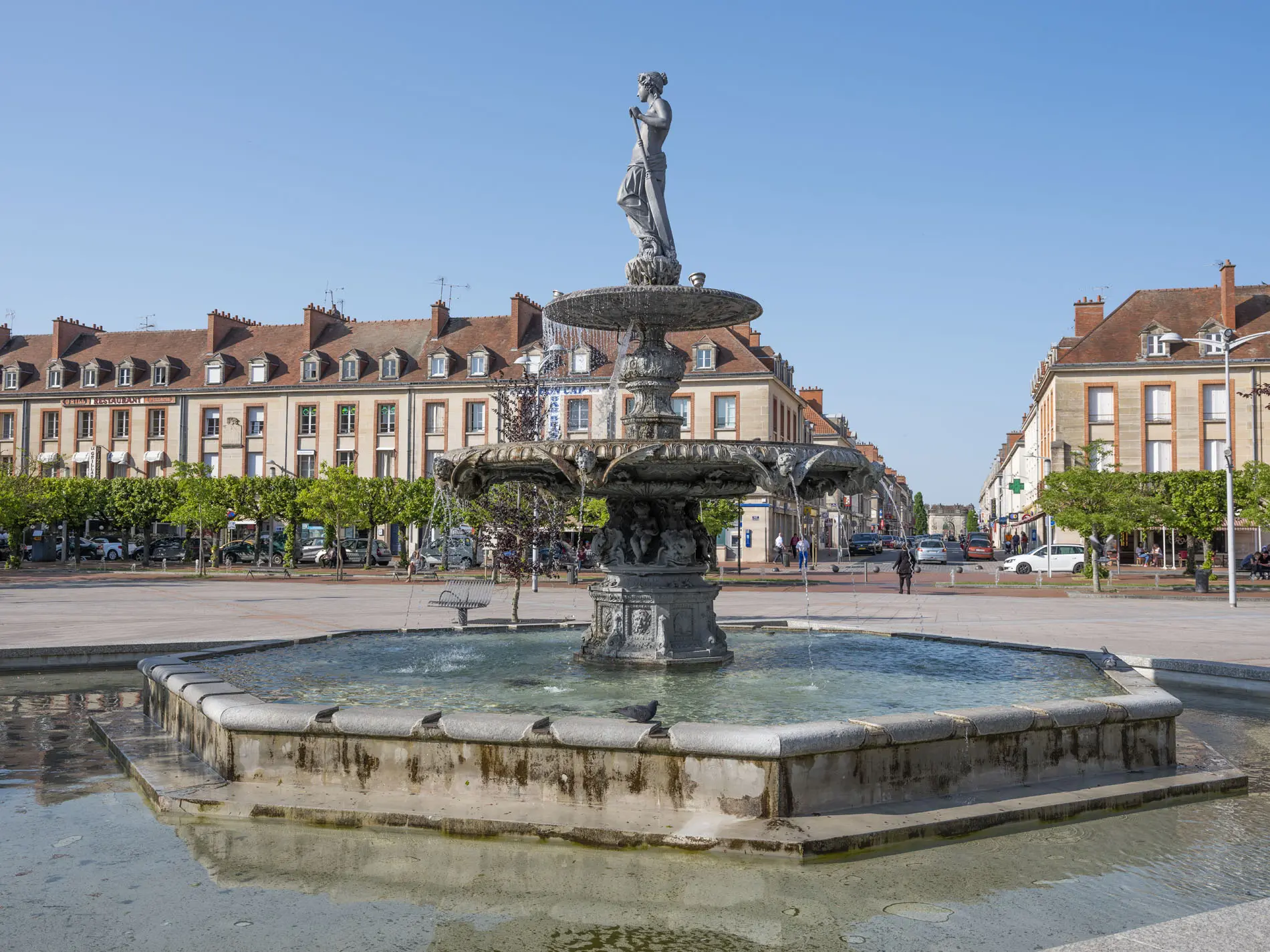
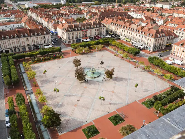
12Place d'Armes and statue of the Marne River
This semi-pedestrianised square, which was once used for military drills, features a statue of the Marne River, ‘the Goddess’, overlooking a fountain in its centre. She symbolises the Marne River, towards which she is looking, and the traditional activities of the region: the vineyards surrounding Vitry and river transport. She holds an oar in one hand and a bunch of grapes in the other.
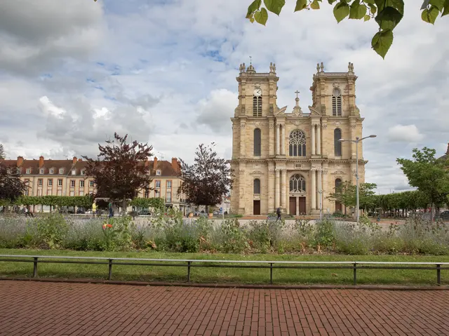
13Notre-Dame-de-L'Assomption Collegiate Church
Considered one of the most beautiful 17th-century churches in eastern France, its construction took 269 years (1629–1898). Inside, the exceptional brightness is due to the high windows and shell-shaped windows above the basket-handle arches, which are quite rare in France.
The 13 chapels contain beautiful 17th- and 18th-century altarpieces decorated with sculptures and paintings. The large 18th-century organ has been listed since 1963 and was originally built for the Cistercian abbey of Trois-Fontaines.
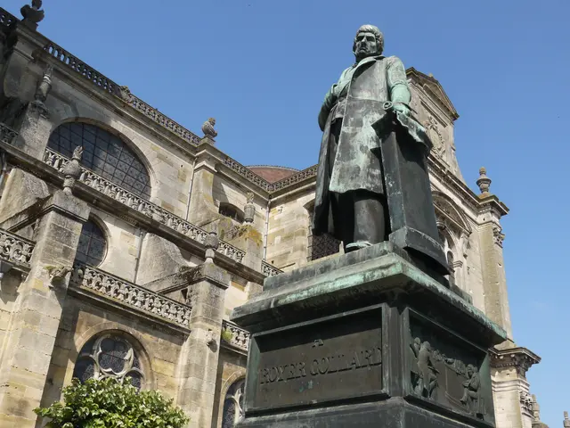
14Royer Collard Statue
19th-century bronze statue of Pierre Paul Royer-Collard, statesman and academician born in Sompuis (51). Work of renowned sculptor Carlo Marochetti (statue of Richard the Lionheart in front of Westminster Abbey, bust of Queen Victoria, etc.).
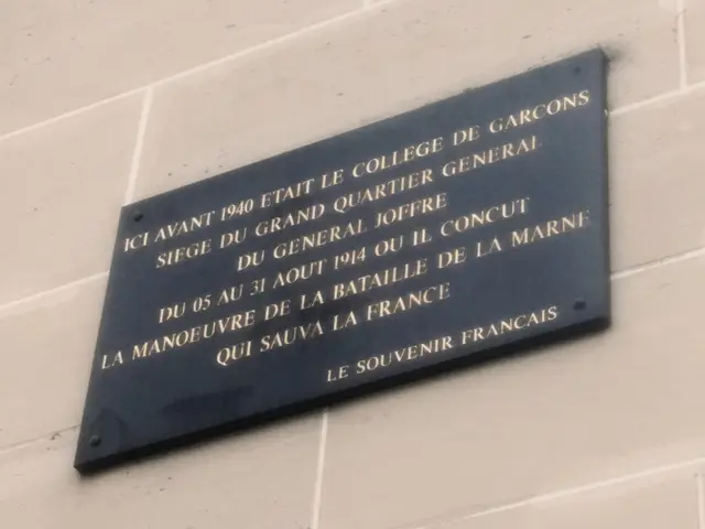
15Headquarters of General Joffre
On 3 August 1914, Germany declared war on France. On the 4th, the future Marshal Joffre established his headquarters in Vitry-le-François, in the boys' school, before leaving in the face of the German advance. However, Vitry was recaptured by French troops on 11 September due to its proximity to the front line (barely 60 km away). The site was used as an ambulance station (hospital) for French and German wounded throughout the war. In 1922, Vitry was awarded the 1914-1918 War Cross by André Maginot himself.